
This list provides some information about some of our larger ongoing projects.
Online media exposure
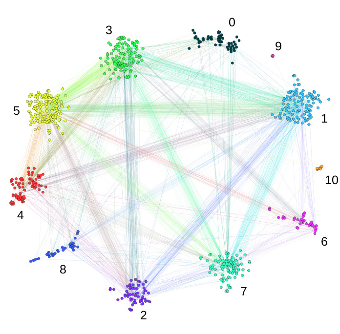
An active area of research in SEDAlab concerns the dynamics of online exposure to news and other media, especially around UK politics and the contested issue of climate change. New patterns of content exposure and dissemination are constantly recognised by mainstream media but their structural dynamics and development are not widely understood. Our work has examined how news is shared on social media, event detection from real-time news streams, ideological bias in online news platforms, and how network bias creates political/environmental echo chambers. This work has been funded by ESRC, EPSRC and commercial sponsors.
Social Sensing
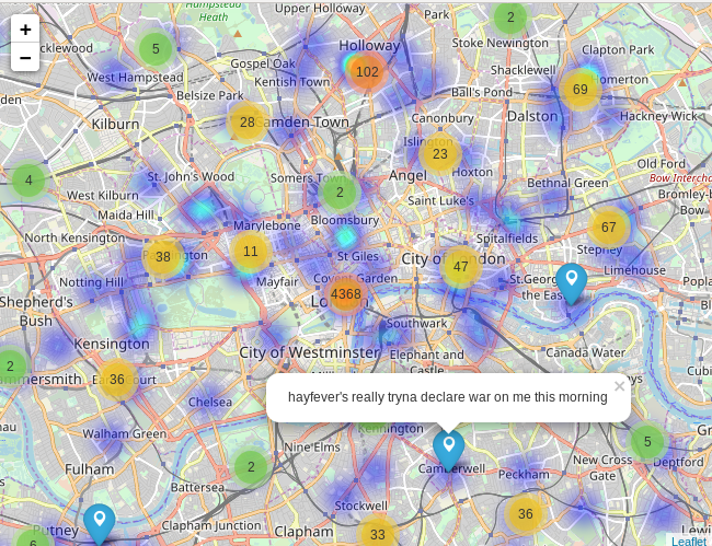
This research strand seeks to use social media data to identify real-world events, especially for natural hazards and extreme weather. Several projects are ongoing or have been completed in this area, developing social sensing methodology and applying it to flooding, windstorms, pollen/hayfever and wildfires. External partners include the Flood Forecasting Centre, Environment Agency, Met Office, Public Health England and Asthma UK, amongst others.
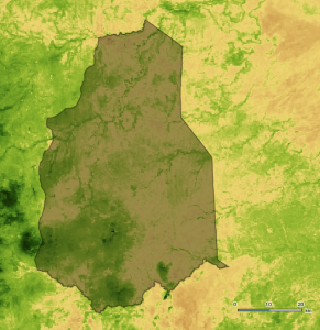
Remote sensing for socio-ecological resilience in Kenya
This new project is combining remote sensing (satellite imagery) of vegetation with on-the-ground data collection by local NGOs to understand the links between climate, tree cover and resilience. Working with the TIST programme in Kenya our work is comparing inferred patterns of tree/forest growth from satellite imagery to the measurements taken by local tree-growers in Kenyan villages. Using data collected by TIST over several decades we will relate forest management by local farmers to socio-ecological resilience to drought and climate change. Initial funding came from the Global Challenges Research Fund and the Alan Turing Institute.
NERC BigFoot
Given the potential for damage to infrastructure and personal property from windstorms, understanding their footprint is important for insurers and infrastructure providers. Currently, meteorological observations and numerical weather models are used to estimate affected areas. This NERC funded project will improve the spatial resolution of the estimates by making use of less structured datasets containing amateur weather observations, social media conversations and CCTV footage.
