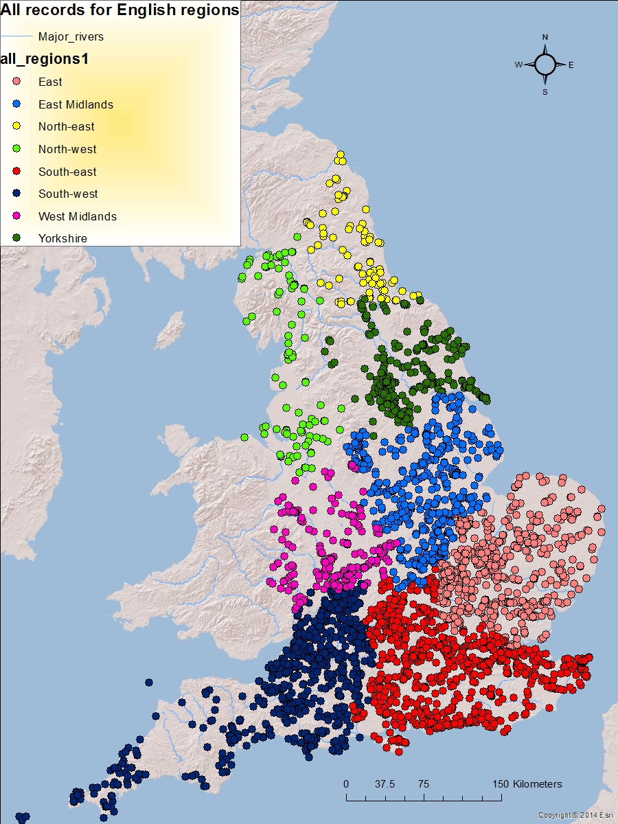
Records by Region, credit: Roman Rural Settlement Project
On Friday 15th January our Departmental Seminar Program kicked off with Neil Holbrook of Cotswold Archaeology talking to us about the fascinating Roman Rural Settlement Project. This project, undertaken in collaboration with the University of Reading and funded by Historic England and the Leverhulme Trust, was conceived partly in response to the almost mechanical excavation, publication and discussion of Roman Rural Settlements, due to the perceived similarity of the sites. The project aimed to highlight the differences in life experience of people living at rural settlements.
The boom of developmental archaeology in 1990 meant that the sample size of excavated Roman rural settlements had dramatically increased. These excavations were to be the focus of the RRS project, with equal weight placed on ‘grey’ unpublished literature as that which had been published. Holbrook explained the mammoth nature of the task, which was to also include all kinds of archaeological data, with equal importance given to site plans, artefacts, animal bones, etc. This was met with many satisfied nods around the lecture theatre.
The end aim of this project was to create a searchable database – a tool for archaeologists (and, indeed, anyone) interested in Roman Britain to use for their research. Themes of chronology, geographical spread, settlement types, growth and decline, amongst many others, were to be made explorable by this resource. The database also carries all grey literature in pdf form, an incredibly valuable resource available on the Archaeology Data Service.
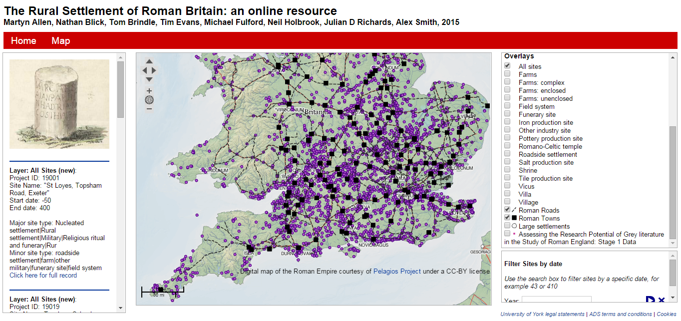
Having a play with the online resource map
Holbrook concluded by giving us a taste of the emerging conclusions of the project. One of the most ground breaking conclusions was that there was a big rise in settlements in use over time with a peak in AD 150-200 and subsequent decline. This suggests that the Romano-British population was at its highest in the 2nd century AD, in contrast to traditional thinking. He also highlighted the Central Belt zone which showed some interesting patterns, particularly in the Cotswolds where decline in settlement use was not so marked as in other areas. There specific geographical and chronological patterning of curvilinear architecture, courtyards and palatial villas. Holbrook suggested that there could have been an increased population, prosperity or perhaps proximity to the military in the Central Belt zone, or perhaps dense settlement of agricultural land, that could have caused differences in settlement morphology, burial practices and perhaps cultural traditions.
We can’t wait to see what other fascinating conclusions come from the project! Anyone interested in playing with Roman data can have a go for themselves over at the Archaeology Data Service.
Written by Emily Johnson.