This month we are showcasing our place illustrations, which will be used during Guided Conversations in individual pilot sites during the research…
Parish of Feock, Cornwall (UK)
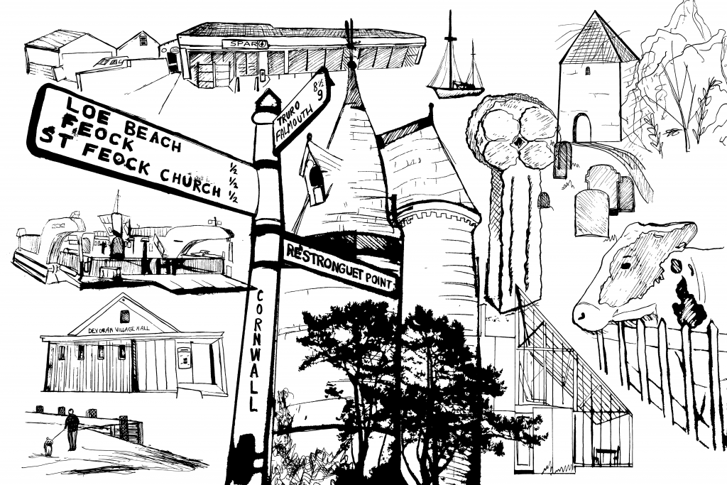
A cow peers over a wooden picket fence close to a Celtic cross, one of the waymarkers in Cornwall that still stands on ancient rights of way. A ship drifts in the sky, which is punctuated with trees and cliffs, farm buildings and a Spar shop. A lone dog walker stands on the quayside, looking out across the water towards the village hall. A village signpost nudges a fairylike stone tower that sits on the edge of a National Trust garden. The Docks, an icon of Falmouth’s modern shipping industry, melds past and present, overlooking the third deepest natural harbour in the world…or is it? Maybe, to you, it’s the ferry chugging across the river; perhaps the fairytale tower brings to mind your local church and community, or the dog walker is actually not on a quayside at all, but in your local park (and just out of sight is the dog walking group you have been longing to join).
The images have all been created to bring to mind local elements in each of our project pilot sites. This image was designed for participants living in the Parish of Feock in Cornwall, which spans several villages. Some depictions, such as specific landmarks, are unmistakable; others are more malleable – in fact, the story changes depending on who is doing the viewing. That’s exactly what we want. These images are able to elicit unique responses that are beyond top of mind thoughts and feelings as participants are asked what it’s like to live in their community. They may trigger ideas and experiences that give a deeper insight into what life is like in the community in which they live – and what might be changed or added to make it better for them as they age.
Le Nord (France)
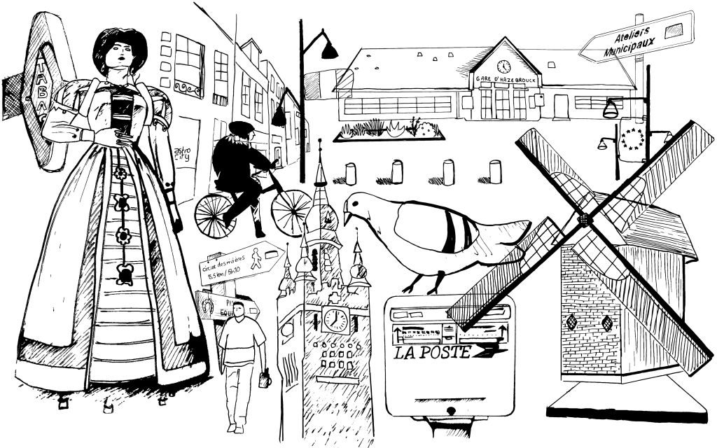
As one resident puts it: “The days of “grey” skies has arrived in the Hauts-de-France region. It may be a bit “challenging” sometimes but it is part of the cycle of nature. And, it’s a beautiful region, especially in the spring…” In this image are the ubiquitous Tabac and La Poste, familiar signage to all inhabitants, with some hints to urban life, such as the Merville town hall and the station at Hazebrouck. The more rural traditions are also visible: the dresses of Flanders, for example, which are well known, and the sight of a Bailleul windmill in the distance, a feature of countryside walks.
East Sussex (UK)
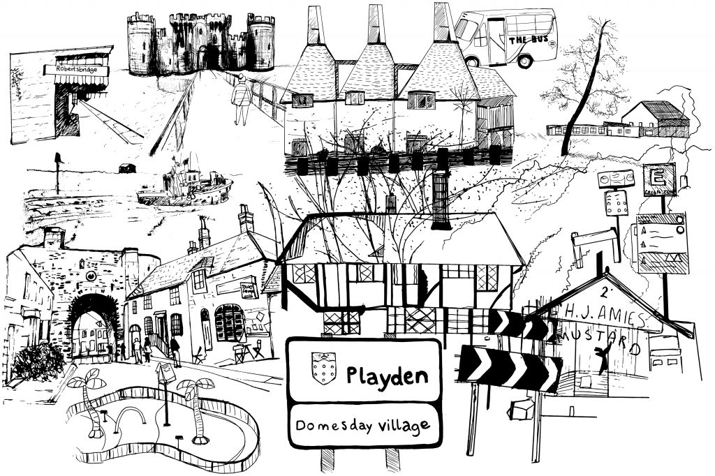
Historic landmarks that will be familiar to residents are here: a walker crosses the moat to visit Bodiam Castle; a street sign for Playden, a village first recorded in the 1086 Domesday Book, is at the centre; transport links are evident: the bus and the train station, with links into London, suggest its position out of the city. There is evidence of the water: a playground near Camber Sands, a famous stretch of beach, is alluded to – perhaps an opportunity here to recall trips with children and grandchildren. The oast houses are a familiar sight on the horizon.
Laakdal (Belgium)
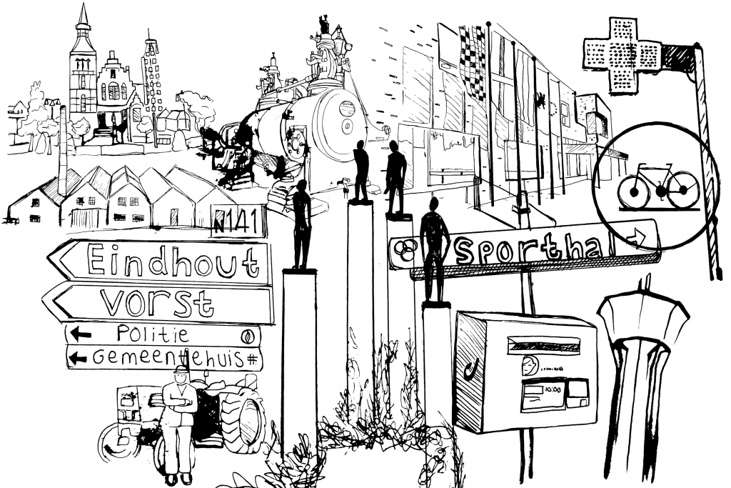
There are four small parishes conjured up in this image: Eindhout, Veerle, Groot-Vorst and Klein Vorst in the municipality of Laakdal, Flanders. Laakdal was named after the valley (dal) of the river Laak. Key landmarks include the old town hall, in the upper left, in Eindhout; the water tower (bottom right) in Veerle; dotted about the image are figurines from the garden of a building housing adults with disabilities. A man leans against a tractor, similar to those found in Groot-Vorst.
Goes, Zeeland (The Netherlands)
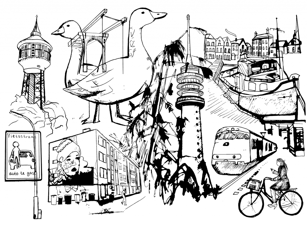
Goes is a city within the rural municipality, criss-crossed with waterways; you can see a typical boat, train and of course, someone riding their bicycle – in this case, commuting. There is distinctive street art on the sides of buildings, evidence of the new merging with the historic architecture. Many of the graffiti murals include geese as a symbol of the area (Goes is pronounced almost like goose or “ghoosh”, with a distinctively soft ‘g’.) Two towers are included as points of reference; the water tower south of Goes, and the TV tower in the North.
Poperinge (Belgium)
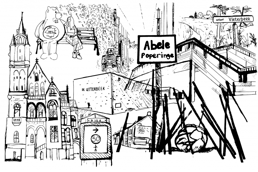
Last, but not least, residents will recognise the statue of Warme William, the local mascot, seated on a park bench in the town of Poperinge (he is usually blue). He is a symbol of community connection and resilience. Other familiar features of the town include the town hall and the library, (Letterbeek). There are public art installations in the local area; a monument to the Paardenmarkt, the old horse market, is alluded to in the bottom right of the image. The rural life surrounding the town is depicted by the tractor and foliage at the top of the image, and the Vleterbeek is a waterway, with trails along streams and grassy landscapes.
We worked with design company MAP Digital to create unique stimulus materials for each location. The images are supplementary tools in our Guided Conversations to help explore people’s experiences, needs and desires for healthy ageing. The response from participants will help shape the final toolkit (including visual designs) which is due for completion in March 2022.
